

 English
  Español
 Português
 русский
 Français
 日本語
日本語 Deutsch
 tiếng Việt
 Italiano
 Nederlands
 ภาษาไทย
 Polski
 한국어
한국어 Svenska
 magyar
 Malay
Malay বাংলা ভাষার
 Dansk
Dansk Suomi
Suomi हिन्दी
 Pilipino
 Türkçe
 Gaeilge
 العربية
 Indonesia
 Norsk
Norsk تمل
تمل český
český ελληνικά
 український
 Javanese
 فارسی
فارسی தமிழ்
தமிழ் తెలుగు
 नेपाली
 Burmese
 български
 ລາວ
ລາວ- Latine
 Қазақша
 Euskal
 Azərbaycan
 Slovenský jazyk
 Македонски
 Lietuvos
 Eesti Keel
 Română
 Slovenski
 मराठी
मराठी Srpski језик

Products
- Boom Sprayer
- Air Blast Sprayer
- gramina metentis
- Rota Rake
- Terra Leveler
- stercorat Spreader
- Stercus Spreader
- Seeder Machina
- Agriculturae machinatione Transmission Shaft
- Aratrum
- Automatic Roll tube Sprayer
- Calces soleat
- Hydraulica valvae
- Straw Net
- Tractor Flail Mower
- Germen Mors Machina
- Gyratorius Rake
- Sarculum Solis
- Riding Machina
- Gyratorius Tiller


Satellite terra Level Laser terram Leveler
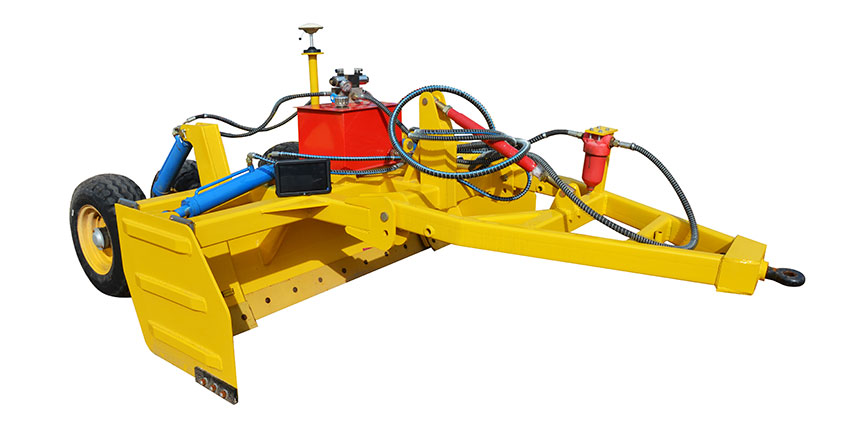
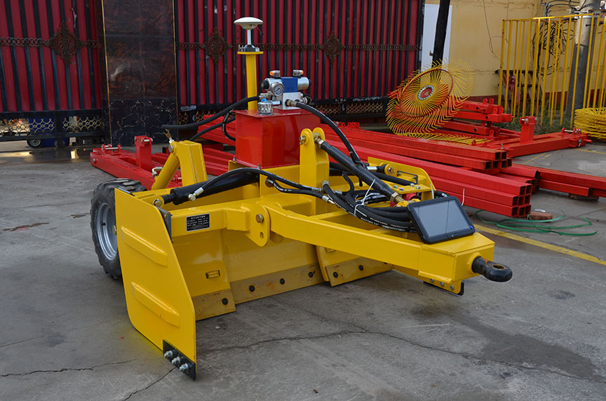
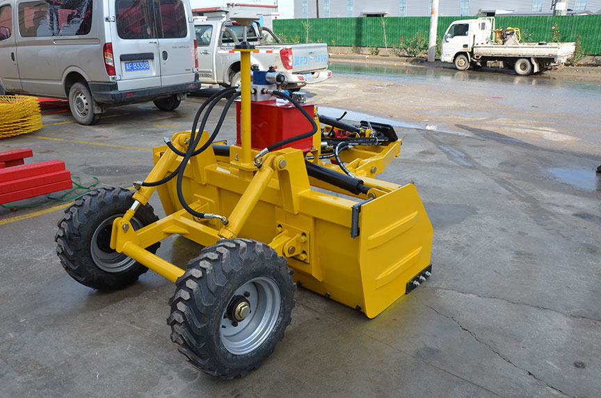
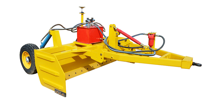
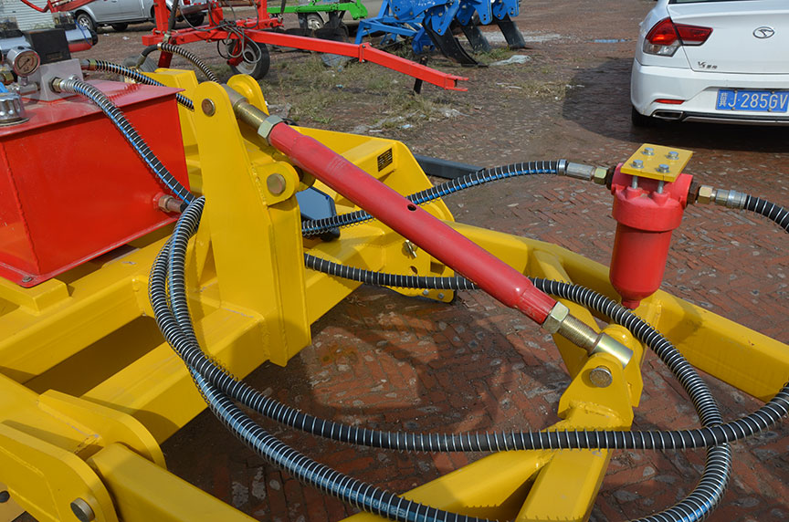
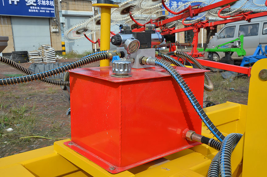
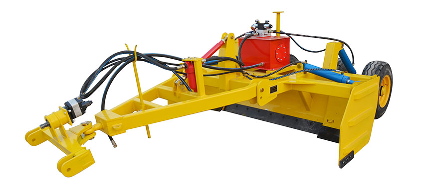
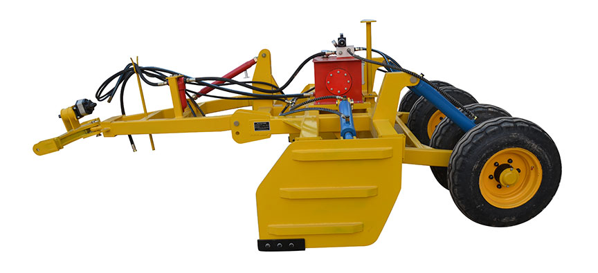
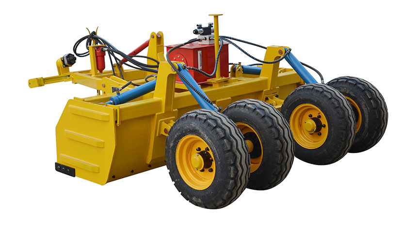
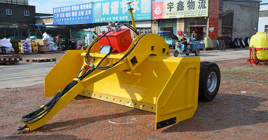
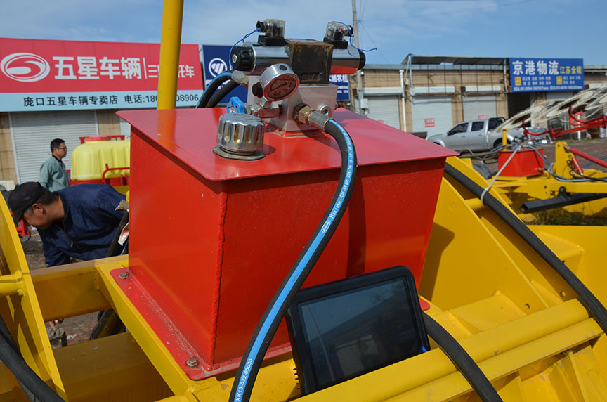
Shuoxin est professional manufacturer de Satellite terram Level laser terram Leveler. Machina utitur wireless tradenda signa, quae traducitur ad moderatorem per radio station, enabling ad rationem computare positus notitia de rutrum cum altius accurate. Praeterea, quod utitur differentiale positioning technology ad consequi summus praecisione adtritio operationes, sustinet fastigio adtritio, improves solo productio conditionibus, et comprehensively amplio farmland productivity.
Mitte Inquisitionem
depictio producti
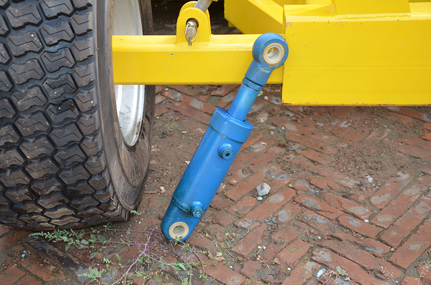
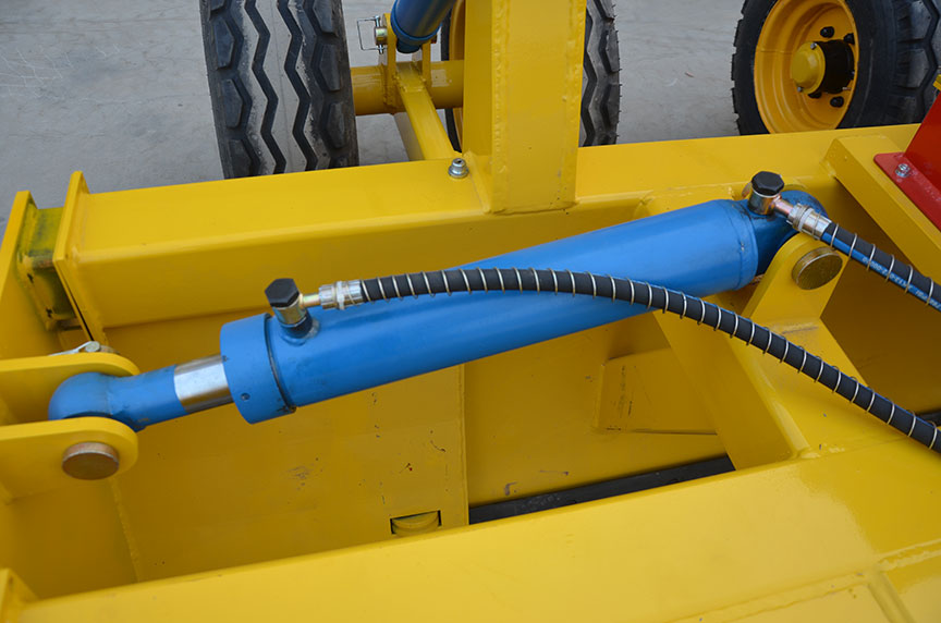
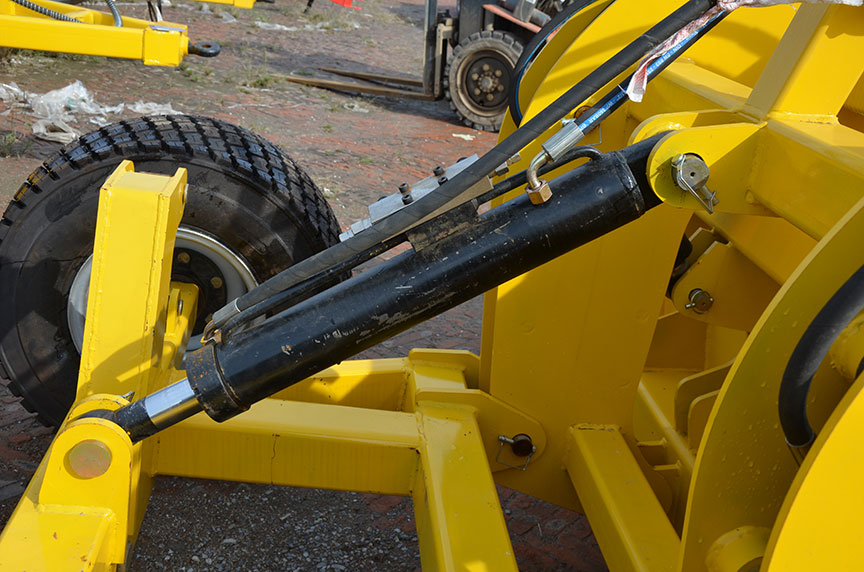
Vos can directe emptio summus qualitas satellite terram gradu laser terram Leveler a nobis ad low pretium. Nostrum Satellite horizon apparatus utitur wireless tradenda signa ad rationem referat reference planum per legendo puncta comparat in loco rutrum cum referat planum et obtinet extensionem et contractionem terminum cylindri per aliquam algorithm. InShuoxin Satellite terra Level laser terram LevelerNon affectus vento et loca elevatio differences, et transmissione longe potest pervenire plus quam V chiliometrorum.
Product parameter
| Exemplar |
12pw, 2.0 (l) |
| Working Width |
2 |
| Imperium modus |
Laser Imperium |
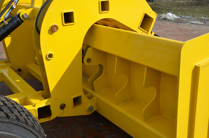
| Type shovel adtritio |
Rectum rutrum |
| Tyrus magnitudine |
CCXXV / 65R16 |
| POPULUM |
50.4-80.9 |
| Opus rate ha / h |
0.2 |
| Magnitudo |
MMDCCC * MMXL * MCLXX |
| Pondus |
670 |
Peculiarity De Satellite terra Level laser LeVeler
- Verus-tempus map ostentationem:Operatio Track, High et Low Terrain Map, intuitive et patet, adtritio efficientiam potest auctus per XXX%
- Compatible cum varietate plana scutras:Adaptable Telescopic TRANSFERELING, soli laxitas TRANSFERELING, PADDY agro radiis, scrapers et importari plana scraps
- XXIV-hora omnibus, tempestate operatio:Dies noctuque fortis ventus pulvis haze alias tempestas potest operari
- Plena coverage of Network annuit:Non opus est ad extruxit basi stationibus, infinita operantes spatium, salvis labore constat per XV%
- Auto-adjusting datum, accurate et efficient:Et ratio automatice recognizes altitudinem locorum et statim accommodat terram datum, quod potest amplio operatio efficientiam a XX%
Hot Tags: Satellite terra Level Laser terram Leveler
Mitte Inquisitionem
Libenter placet, ut inquisitionem tuam in forma infra exhibeas. Respondebimus tibi in 24 horis.


X
Crusulis utimur ut meliorem experientiam pasco tibi praebeamus, situm negotiationis et personalize contentus analyse. Hoc situ utendo, ad nostrum crustulorum usum consentis.
Privacy Policy